
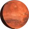
Mars Map with Feature Names
Explore the mysterious and captivating surface of Mars with our detailed Mars Map! This interactive tool allows you to discover and learn about the various features of the Red Planet, from its vast plains and towering volcanoes to its deep canyons and impact craters.
Features
- Interactive Mars Map: Navigate Mars's surface effortlessly with our interactive map. Zoom in and out to explore different areas in high detail, revealing intricate details of the Martian landscape.
- Named Features: Identify major Martian features such as volcanoes, valleys, plains, and craters. Each feature is labeled with its official name, providing a rich educational experience.
- Detailed Information: Click on any labeled feature to view detailed information about it, including its size, location, and interesting facts. Learn about the history of each feature's name and its significance in planetary science.
How to Use
- Explore the Map: Use your mouse or touch gestures to pan across Mars's surface. Zoom in for a closer look at specific regions or zoom out for a broader view.
- Identify Features: Hover over labels to see the name of each feature. Click on labels to open a pop-up with more detailed information.
- Search Functionality: Use the search bar to find specific Martian features by name. Quickly locate famous landmarks like Olympus Mons, Valles Marineris, or Gale Crater.
Start your Martian exploration now and uncover the many wonders of Mars with our comprehensive Mars Map!
Mars Surface Features Facing Earth
Valles Marineris
Vallis
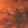
Vast canyon system stretching over 4,000 km, sometimes called the 'Grand Canyon of Mars'.
Tharsis Montes
Mons

Chain of three large shield volcanoes (Arsia Mons, Pavonis Mons, Ascraeus Mons) on the Tharsis bulge.
We would like to acknowledge the invaluable resources provided by
Solar System Scope
for the high-resolution planetary textures, and the
Gazetteer of Planetary Nomenclature
for accurate planetary naming conventions. These contributions have greatly enhanced the quality and accuracy of our project. However, we take full responsibility for any errors or inaccuracies in our use of these resources.