
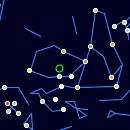
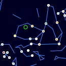
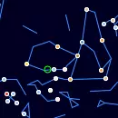
Vela Constellation
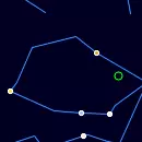
Double-click to unlock the map.
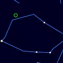
Vela, the sails, is a southern constellation that was once part of Argo Navis, representing the sails of a ship.
Vela Rise and Set Timetable
| Time | Elevation | |
Moon Rise, 16.9% illuminated 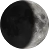 | 08:54 | -9° |
| Moon Set | 21:09 | -53° |
| Astrosession begin | 00:28 | -77° |
| Astrosession end | 02:55 | -60° |
| Vela Rise | 10:41 | |
| Vela Transit | 12:21 | 3° |
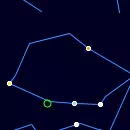
Track Vela Position Throughout the Night
← Sun, 19 July 2026 →
| Time | |
| Altitude | |
| Azimuth |
Shift the map to change the time and observe Vela changing position in the night sky.
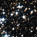
Nebulae in the constellation Vela
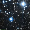
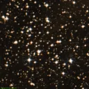
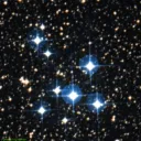
Omicron Velorum Cluster (IC2391)
Open Cluster

IC2391 is an open cluster with apparent magnitude 2.50 in the constellation Vela, spanning approximately 29.1 arcseconds in the sky.


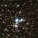
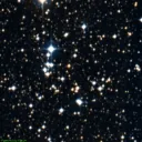
Pencil Nebula (NGC2736)
HII Ionized region

NGC2736 is a hii ionized region with apparent magnitude in the constellation Vela, spanning approximately 30 arcseconds in the sky.


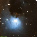
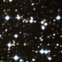
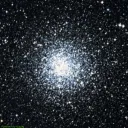
Eight-Burst Nebula (NGC3132)
Planetary Nebula
NGC3132 is a planetary nebula with apparent magnitude 9.20 in the constellation Vela, spanning approximately 0.5 arcseconds in the sky.


Annual motion of Vela
| Date | Mon, 20 July 2026 |
| Twighlight start | 20:08 |
| Twighlight end | 02:09 |
| Twighlight duration | 6h 1m |
| Rise | 10:37 |
| Set | 13:56 |
| Elevation at transit | 3° |
| Transit time | 12:17 |
| Equatorial coordinates | RA: 09h 03m 58s", Dec: -49° 54' 52s |
| Magnitude | - |
| Constellation |
The graph illustrates the annual visibility pattern of a Vela, providing a comprehensive overview of its daily appearances and transit times throughout the year.
The graph is structured with the vertical axis showing the hours of the day, ranging from 12 AM to 12 AM the next day, while the horizontal axis spans each day of the year.
The reddish shaded area indicates the periods when the Vela is above the horizon, visible to observers. The white line marks the times when the celestial object reaches its highest point in the sky each day, known as the transit. You can also view detailed visibility information in a dedicated table, including exact rise, transit, and set times for each date.
Acknowledgements
We gratefully acknowledge the International Astronomical Union (IAU) for defining and standardizing the official constellation boundaries, which provide a consistent framework for celestial mapping.
Special thanks to Sky & Telescope Magazine and contributors Roger Sinnott and Rick Fienberg for their collaboration in producing the charts and tables. The constellation patterns, drawn by Alan MacRobert, were influenced by the work of H. A. Rey and thoughtfully adjusted to align with earlier traditions.